Monitor It, Save Resources and Grow Better Crops
Your Field in the Palm of Your Hand
A field – the main asset of every crop grower. But do we really know what is happening in it? Are we able to harness the data and benefit from it? We spoke with Mr Branko Majerič who certainly can.
The story begins in Slovenia – the only country with “LOVE” in its name. Located in the middle of Europe, just south of Austria – we are visiting the Majerič farm on the Ptuj field, in the village of Moškanjci.
The farm has a long tradition of growing field crops (wheat, corn, sunflower and rapeseed), cultivating white cabbage for fermentation and is one of the few farms growing Ptuj onion, known also as “Ptujski lük” – the 200 years old indigenous variety of onion only grown in this part of Slovenia and only in a specific type of soil. It is the first garden crop in Slovenia to receive Protected Geographical Indication (PGI) status and, given its rarity, extra effort is put into ensuring its best quality.
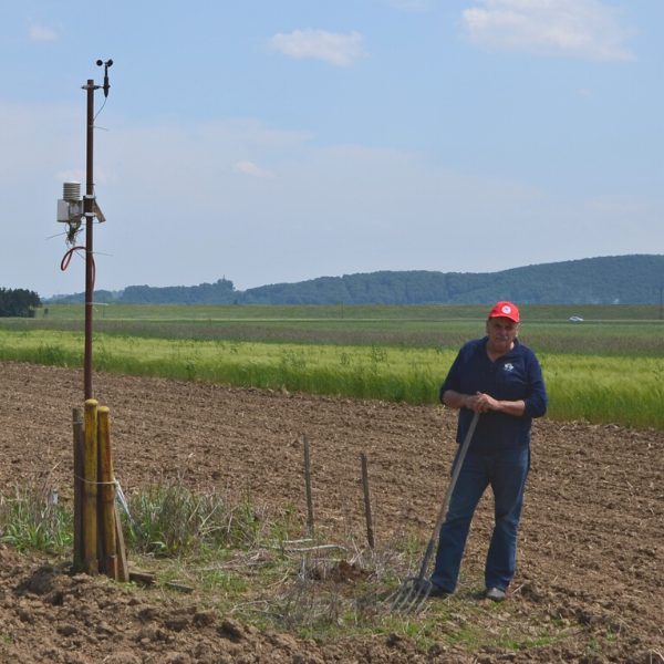
Mr Branko Majerič himself is a soil expert and pays a lot of attention to what is happening in his field, all with the help of an iMETOS station. The first thing he points out when we sit down is the main difference between crop growing and other types of farming: “Farming usually follows the logic ‘bigger is better’. Bigger farm – better cows – more milk. With crop growing it’s not like that because we are trying to look into what cannot be seen with a naked eye. Bigger field does not necessarily mean better produce. Better soil and smarter cultivation do. And crop growers, as the designated guardians of nature, don’t always pay enough attention to it.”
To help guard fertile land and to keep as much humus in the top layer they have been using the shallow “no-till” technique of land cultivation for 20 years now. The iMETOS station has been in regular use since 2011 and has shown an interesting insight into what is actually happening in the field.
“With all the information it is easy to see and understand how water travels through the soil after rainfall, how the temperature in the ground and air changes, how the sun affects evapotranspiration and how all this will affect work in the field. All decisions – irrigation, spraying, harvesting; are based on the actual data on site, not some approximations from national weather stations far away from the field. ” he explains.
He places great importance on monitoring micro locations, especially in such a geographically diverse country as Slovenia. Various combinations of relief, hydrology and soil types make it impossible to generalize measured data from one location to the whole area.
“Measurements that I take on my field are only relevant for that specific field. I cannot use the data for my other pieces of land 10 or 20 kilometres from here because soil types differ so much. It’s very important to be aware of that.”

iMETOS as your personal “consulting tool”
The weather station, set up on Mr Majerič’s field is the iMETOS 2. It has been set up in 2011 as cooperation between International Atomic Agency Vienna, the University of Ljubljana, BASF Slovenia, Pessl Instruments and the Majerič farm.
The parameters being measured are air temperature, soil temperature on different depths, soil moisture, solar radiation and evapotranspiration and are used as a decision support system for more optimized work in the field.
“The information given by the national environment agency is not precise enough. They predict an approximate amount of rain, approximate crop coefficients, an estimated wind speed and solar radiation. This is not good enough. What we need is individual and precise information.”
Having on site data means that you can do exactly what your field and crop need.
You can decide not to irrigate when everybody else thinks it’s already time to do it and in doing so save valuable resources and money. You can decide whether or not it is good time for spraying (wind, rainfall and solar radiation) and again save resources by choosing the perfect spray window and more.
He concludes: “It’s great to see how technology advances. People used to predict weather by looking this way and that way, judging by the amount of clouds and their colour. Now we don’t have to do that anymore because we can have actual data anywhere and anytime we want. It’s a shame that not more people are aware of the benefits. ”
